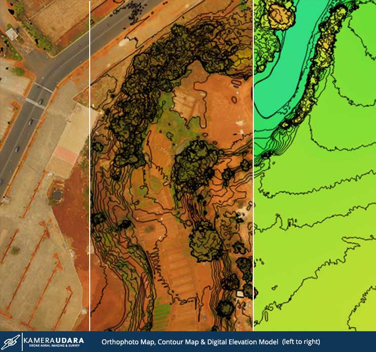
We deliver you a high accuracy maps that will enable you take informed
and targeted action within the area. Aerial maps give a level of insight that’s invaluable to industries such as agriculture, construction, mining, and land and resource management, or for gathering data for any area that needs to be looked at closely and often. Our mapping drones could produce 2D Orthomap and 3D Maps. Our low flying drone able to produce high resolution map as high as 5 Cm per pixel spatial resolution map. From the gathered data, the map can generate contour data and Digital elevation model (DEM) data. Through DEM data our software can measure height and volume. Our drone also equipped with Multi spectral camera for tree counting and NDVI to support precision agricultural.
Why ?
Why use Drone or small unmanned aircraft system (sUAS) for mapping :
1. Fast
Data acquiring process is fast using Drones. Our Drones can cover 1000 hectares for 1 to 2 days. Our aerial mapping service is faster than conventional survey, making sure it affect your bottom line faster.
2. Cheaper
Compared to conventional surveying. Drones is faster and cheaper since less man hour is involved. We provide aerial mapping service lower cost than conventional survey.
3. Accurate
Drone imagery is accurate since the drone is flying in a low altitude. We can generate high resolution map up to 5 cm/pixel resolution. We provide an accurate aerial mapping service by using high resolution cameras.
4. Cloud Free
Since our Drone is flying low about 100 meters to 150 meters. The imagery won’t be obstructed by the clouds. We provide cloud free aerial mapping service fast, accurate and inexpensive.
Uses
Uses of Aerial Mapping :
- Visual observation
- Project Monitoring
- Stock counting
- Plant stress level checking
- Planning
- Property marketing
Equipment Used
Kamera Udara use a small unmanned aircraft system (sUAS) or Drones that is designed for Aerial mapping purposes. Our drones are equipped with GPS flight controller that will ensure a precision flight for surveying purposes.
We use high resolution camera and multi spectral camera to fulfil your needs.


Operation Procedure
Kamera Udara consist of high experienced operator that have years of experienced and supported with the right professional background in surveying area. we plan our flight paths before we arrive at the location. and our Drone will flight automatically to it’s pre-defined flight plan. To increase it accuracy, we use Geodetic GPS to make a Ground Control Point.
Output
The output of Aerial mapping service is :
- Mapping Report
- Orthophoto Mapping file
- DEM and Topography Data can be generated
- Raw photos

Contact Us
Contact Us for our aerial mapping service quotation or consult to us. We’d be happy to help you.

 WhatsApp us